RockyMountainSummits.com Home  |  My Peak List  |  Message Board  |  Contact Me  |  View the Guestbook  |  Sign the Guestbook


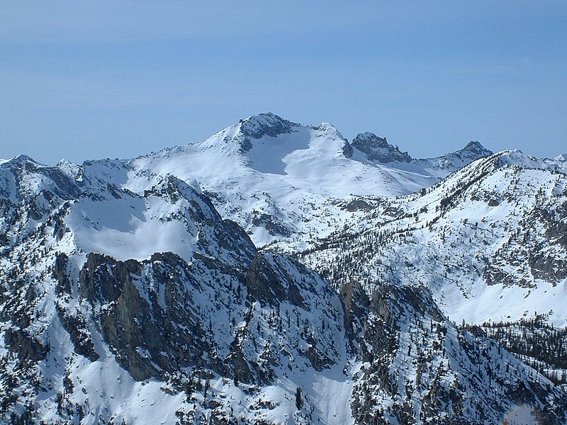
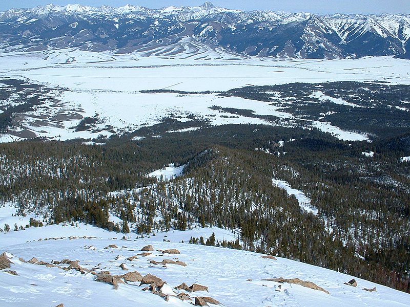
McDonald Peak - 10068 Feet


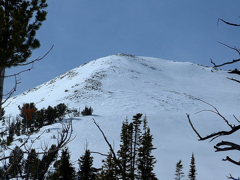
McDonald Peak from around 9400 feet.

Trip Report (3/06/2005):
I must be the king of optimism. While planning a trip to McDonald Peak in the Sawtooths, I expected a challenging, but reasonable day on solid snow. The night before, I dreamt of something like this...

Kevin and I would arrive to the Sawtooth Valley to bright blue skies, with the sun casting orange rays onto the Sawtooth Peaks. After that we would find an easy approach on hard packed snow across the flat valley to the base of the peak. On the ridge we would find more hard-packed, easy to travel on snow (of course!). Once higher on the peak, we might find the occasional drift that had to be navigated through, but things would be good. The last section would be steep, but the snow would offer perfect footing and we'd cruise to the top. On top, we'd nap, brag about our 3 hour ascent, bask in the sun, etc...

4:00 AM
Beep! BEep! BEEp! BEEP! Dang, my alarm. Whoa, 4 AM. This stinks, I want more sleep. Must have more sleep! Snooze.

4:10 AM
Beep! BEep! BEEp! BEEP! 4:10 AM. Argh! Oh well, time to get up there for that easy stroll up McDonald Peak.

8:00 AM
Kevin: "Whoa Dan, that peak looks pretty far away."
Dan: "Yes, this will be a long trip, but the flats here will go fast. Besides, the GPS here says it is only 4.39 miles to the peak."
Kevin: "Alright, but that is as the crow flies."
Kevin: "Hey Dan, snowshoes on or off to start?"
Dan: "I'm leaving mine off. We won't need them until we reach the base of the peak."
Kevin: "Let's hit it."

8:05 AM
Dan: "Damnit! I keep breaking through. This snow should be consilidated, it's been sunny and warm for weeks and it froze hard last night."
Kevin: "Should we put snowshoes on?"
Dan: "Nah, it'll get better."

8:07 AM
Dan: "Ugh. Let's stop and put on our shoes."
Kevin: "You sure?"
Dan: "Yes."

9:00 AM
Kevin: "How far is it from the highway to the base of the peak?"
Dan: "Just 2 miles."
Kevin: "We've been hiking an hour and have like a mile left."
Dan: "Let's just make the ridge, the snow will be hard packed there."

The above is an account of the first hour of a snowshoe trip Kevin and I took to McDonald Peak in the southern Sawtooth mountains. We parked along Highway 75 and hiked across the flats to the base of McDonald's east ridge. The east ridge is forested and not well defined down low, but eventually narrows and joins the peak just below the summit. The last 300 feet are fairly steep and above the tree-line.

As it turned out, the snow on the ridge was not much better snow than the flats. Sure, we had crusty snow from time to time, but usually we were slogging through several feet of sugary, loose junk. Despite the punishment we had been through, we found ourselves 1500' below the summit with improving snow and great weather at 11:30 AM. We decided to push on. 45 minutes later, we were at 9400 feet and could see the rest of the route ahead. The wind had come up and snow was drifting a bit, but it was bearable with a light jacket on. At the base of the ridge, we assessed the avalanche danger and decided there was none. Kevin led this section, which was grueling because of the steepness, but the snow was windblown here and more consolidated. Eventually we reached the last 200 or 300 feet, which was hard packed snow and some rocks sticking out. Here Kevin's snowshoes allowed him to get some purchase on the snow and he cruised. Mine, which do not have crampons further back, would kick out unless I kicked hard at the slope to break through the snow. This made the last slope slow and a bit nerving for me.

The drainage on the south side of the east ridge is quite the site. It is bordered by a long, nearly flat ridge, with steep sides and snow sluffs in the steeper gullies. On the other side of the ridge (up high), there was a terrific looking snowbowl with a huge cornice overhanging it.

On top of the peak we were treated to great views of White Clouds and Sawtooths. We could see the lakes below us, like Redfish, Petit, Alturas, and Perkins. You will find a summit register in the rocks atop the peak. We were the first entry since October 9th. One bad thing we could see from the summit was the black highway in the middle of the Sawtooth Valley. It seemed pretty far away and we knew we had our work cut out for us.

The descent went quickly. We pretty much cut our times to each landmark in half the time it took to ascend (in fact the entire descent took 1/2 the time of the ascent). On the way down, we were forced to re-break trail on occasion and were totally trashed by the time we reached the flats. Here we decided to follow snowmobile tracks back to the highway, even though they would add a bit of mileage to the trip. While a blessing to have solid snow, trudging on these tracks over the last 3 miles across feature-less terrain was painful. Nothing seemed to get any closer as we marched and marched and marched. The truck eventually came into view and alas we were able to take off our soggy boots, change into comfy clothes, and grab some salty snack foods for the way home in Stanley.

Trip stats:
Time: 9.25 hours
Length: 10.5 miles
Cumulative Elevation Gain: 3200 feet
Class (difficulty): 2

Map:
Topo map of the peak.

Drive:
In the winter, park in a plowed pullout about 1.75 miles south of the Petit Lake turnoff or 1.1 miles north of the Alturas Lake turnoff. The pullout is on the west side of the road.

Route:
From the pullout, head due west to the base of the peak. Enter the trees and make your way up the east ridge. The ridge starts out wide and heavily forested. It eventually narrows and joins the summit block about 500 feet below the top.

The summer route is via the north ridge from Petit Lake. This looks like an fun scramble. It is class 3.

Pictures: Click on the pictures below to see the full-size version.
Petit Lake
Kevin snowshoeing with McDonald Peak looming in the distance.
The snowbowl just below the peak.
Frozen Petit Lake.
castle peak
Snowyside Peak from the top of McDonald Peak.
The Rakers from the top.
Castle Peak.
Kevin Donaldson
Kevin getting some water on the top.
Looking down at the route.
North ridge of McDonald Peak.


Please send comments, suggestions, and questions to dan@idahosummits.com.
© 2005 All Rights Reserved RockyMountainSummits.com