Stats
Distance: 4 miles
Elevation gain: 3500' (cumulative)
Class (difficulty): 3
Report:
I have been dying to get out lately, especially with such great weather, but weekends have been taken over by softball. Therefore, Sean and I met up in Mackay on a Sunday night to ascend Mount McCaleb on Monday.
After a short night's sleep at the Bear Bottom Inn, we got on the road around 5am. We drove in circles until finally realizing Main Street was the Bench Road from the trip reports (even later we noticed it was signed as Bar Road). Once finding Cedar Creek Road, we still weren't spared, as roads would dead end at fences or ditches, but we just kept heading toward the base of the peak and eventually got there. The driving difficulties cost us a lot of time, but we were able to drive to 8200' with the last 1000 feet gained on the steepest road Sean and I had ever driven on.
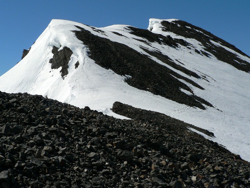
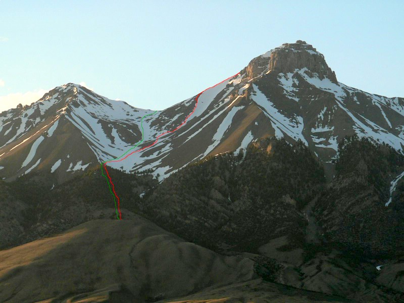
We were heading for the south gully of Mount McCaleb, so from the end of the road we followed a faint path up through the trees. After about 1000' of gain, we dropped down into the gully. The gully in this section was a mess of talus and avalanche debris. That actually made me feel good, because most of the snow on the peak had already slid. We put on crampons and headed up the gully. At around 10000' we decided a steeper gully off to our right looked more fun. We angled over to that gully and started ascending. After some steep hiking up the gully, we decided the top of the gully was beyond our abilities and used a rock slope to get to the top of the gully. Here we found ourselves near the west ridge route, but only 500 feet from the top. We could see the route for almost the rest of the way, so I fought my urge to head over to the west ridge and followed Sean up this rib. The narliest section was between two rock towers because scree covered solid rock and slope was steep. Once through that section, I grabbed some actual rock and made my way out of the bottleneck on some class 3 terrain. The final 200 feet to the summit were on good rock with incredible views of rock towers and steep gullies dropping off to our right.
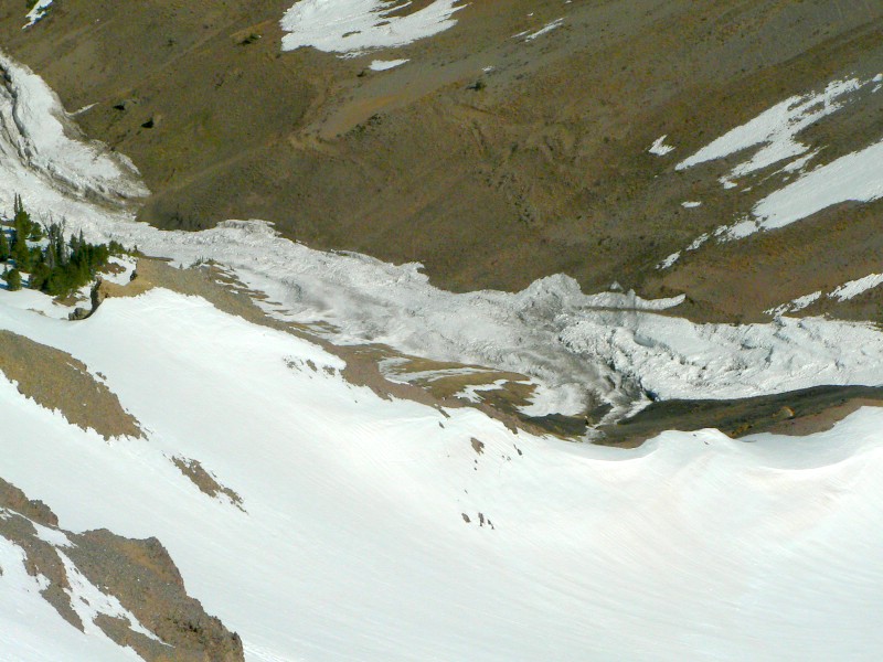
The summit registers were out of the snow on top, but an overhanging cornice kept us from exploring too much. What a view this mountain has. The other thing that was impressive is how steep McCaleb is on each side (with the exception of the side we came up). The north and east faces drop straight down several thousand feet. We were able to see the most destructive avalanche I have ever seen that had started off the north face and ran at least a mile down a creek bottom. A path of destruction was left behind, and you could see scars on the hillside hundreds of feet above the avalanche debris. Hopefully the pictures do that justice� it was amazing!
The sun was now hitting the gully, so I wanted to get down before rockfall and slides started occurring. Sean wanted to bag Little Mac. I didn't like that Little Mac had been in the sun all morning and there was snowfields to be crossed on it and the extra 30 minutes would further loosen things up, so I passed. I headed down the south gully, plunge stepping at times and glissading the final 500'. Once at the bottom of the snow and back in the trees, I tried to soak in as much scenery as possible. Like Sean said numerous times, there isn't anything like the Lost Rivers in the spring surrounded by snow capped peaks. Amen to that!
Getting there:
Take a right on Main Street near the center of town. The road will curve to the right after .4 miles. Turn left onto the signed Lower Cedar Creek Road at 1.9 miles (the sign is facing the other direction). We followed this road until it turned downhill and headed to the mouth of the canyon. We crossed an irragation ditch and ended up on the 4wd road at the base of the mountains. This is the road runs along Cedar Creek an spawns 3 other 4wd roads that creep onto Mount McCaleb. You will pass the first two and ascend up the very steep 3rd (westernmost) road.
Hiking instructions:
We hiked into the gully that seperates Mount McCaleb and Peak 11071 (Little Mac). We actually turned up toward the peak sooner than is normally done and ascended a rib on the west face.
|
|
Photos
|
|
| King Mountain. Just about ready for a snow-free ascent. |
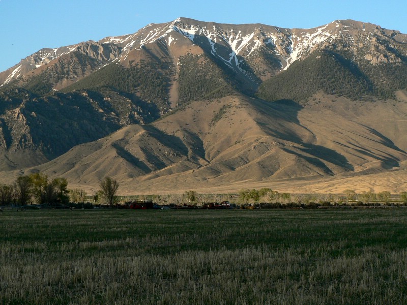
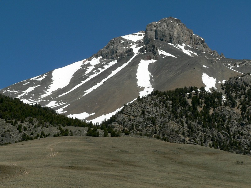
Mount McCaleb in the setting sun. |
| |
|
|
|
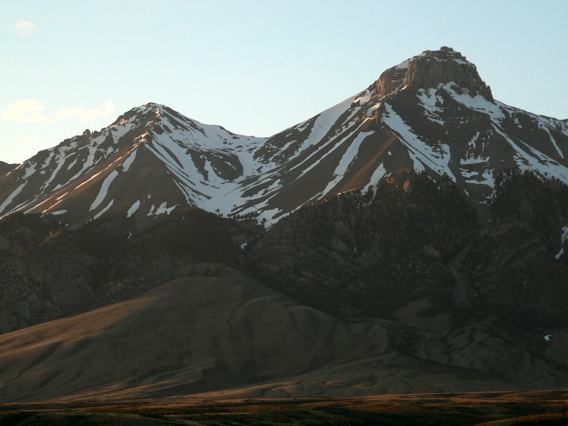
| Close up of McCaleb at sunset. |
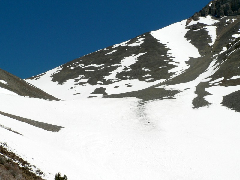
The south gully. Notice the scree slide. Things less noticeable are 2 large rocks at the bottom of the scree and huge piles of snow throughout this area. |
| |
|
|
|
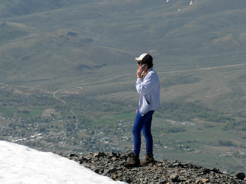
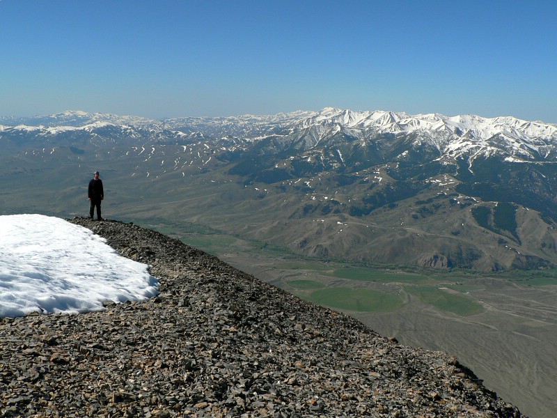
| Sean on the summit talking to mommy. Mackay sits at his feet |
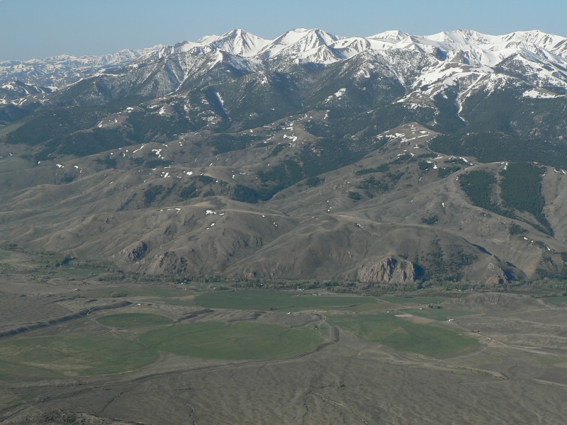
The White Knobs. |
| |
|
|
|
| Me on top. |
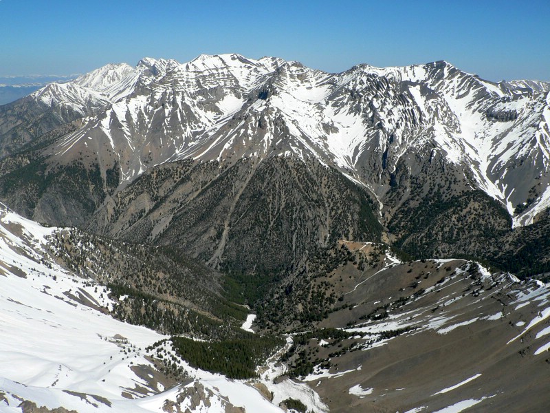
The big Lost Rivers. |
| |
|
|
|
| The west ridge (used to descend). |
Shot one of the avalanche. |
| |
|
|
|
| Avalanche shot number 2. |
McCaleb after the hike. |
| |
|
|
| The routes used. Red shows ascent, green descent. |
|