RockyMountainSummits.com Home  |  My Peak List  |  Message Board  |  Contact Me  |  View the Guestbook  |  Sign the Guestbook


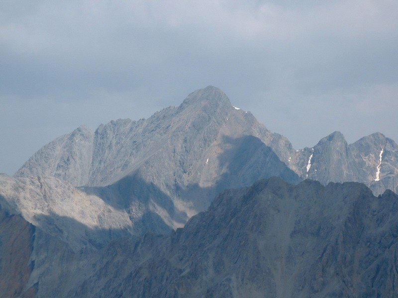
Mount Idaho - 12,065 Feet


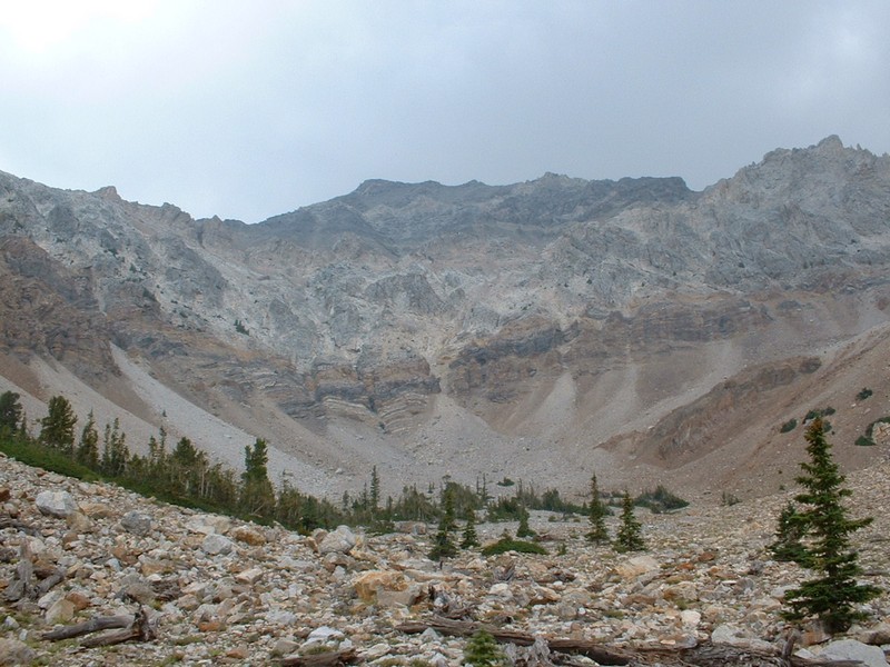
The summit of Mount Idaho from a basin southwest of the peak.

Trip Report (8/17/2003):
It was all setup. Jim had done Leatherman Peak the day before for his 8th 12er, and I had done Mount Breitenbach for my 8th. We headed up Elkhorn Creek along a trail that crosses the creek twice, before deciding to follow a steep mini-gully on the south side of the creek. We lost the trail at some point and just bush-whacked our way to 9,200 feet, where Elkhorn Creek splits and followed the left fork heading northeast (on the way back, we found the trail much higher up on the mountain). After a few hundred yards in the left fork, we turned right and started climbing a steep tree covered ridge. In hindsight, we probably would have stayed in the dry creek bed longer and then ascended that ridge. Eventually, we popped out of the trees at 10,400 feet, with a saddle about 1/4 a mile away and views of Mount Idaho's west face. We tried to find the game trail Tom Lopez mentions in his book. We finally did, but it wasn't much of a help. Once at the saddle, the fun starts, as you have to weave over and around several rock pillars. In a strange turn of events for Lost River rock, this rock was solid and fun to climb on! At around 11,200 feet we found the ledge that Lopez mentions and followed it to 11,500 feet, at the base of a gully. Here we pretty much just stayed on the left hand side of the gully, climbing the class 3 rock to the summit. Jim and I picked different routes on the last 150 feet, but both worked out and got us on top.
The view of Borah from the summit is quite nice, and makes Borah look very pointed. We could see the north face couloir, which several summit log entries mentioned using for early summer snow ascents. Not sure what the view south would have been like because it was smoky. Merriam Lake was visible to the east.

On the way down, we took Painter's route, which has an awesome scree slide for the top 750 to 1000 feet (in calf deep stuff). After the scree slide is over, there is a cool down climb of a waterfall in the gully, then a neat hike through a basin at Mount Idaho's feet that is sure to impress you. Soon after that, we rejoined Elkhorn Creek, took a long and deserved rest in a cool, shaded spot near some springs along the creek, and then hiked out.

Trip stats:
Time: 8.5 hours
Length: 9 miles
Elevation Gain: 5065 feet
Class (difficulty): 3

Directions:
Turn east on Elkhorn Creek road off of Highway 93 about 16 miles north of Mackay. Follow the road under some transmissions lines then to its end at about 1 mile and 7,000 feet. It is a rough road, but I think a passenger car could make it to the start.

Route:
See the trip report above...

Pictures: Click on the pictures below to see the full-size version.
Gully that leads to the summit.
Jim on his final 12er!
Looking down at our route on the west ridge.
 
Borah Peak from Mount Idaho.
West ridge, class 3.
Descent gully that got us to the basin below Idaho.


Please send comments, suggestions, and questions to dan@idahosummits.com.
© 2001 All Rights Reserved RockyMountainSummits.com