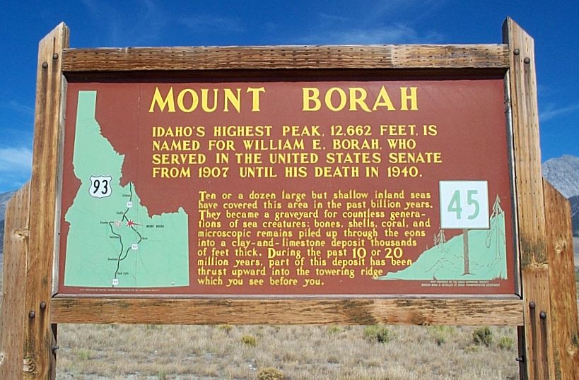
Mount Borah - Idaho's Highest Mountain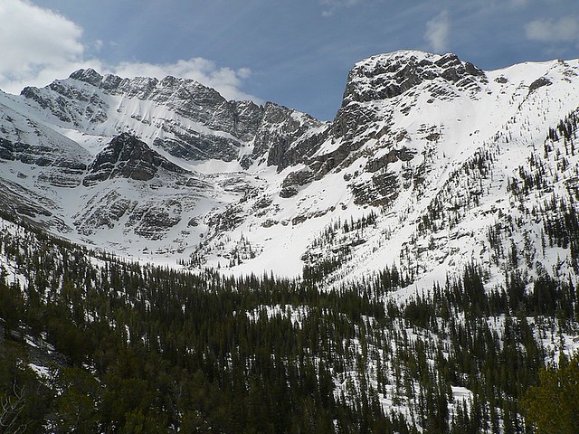
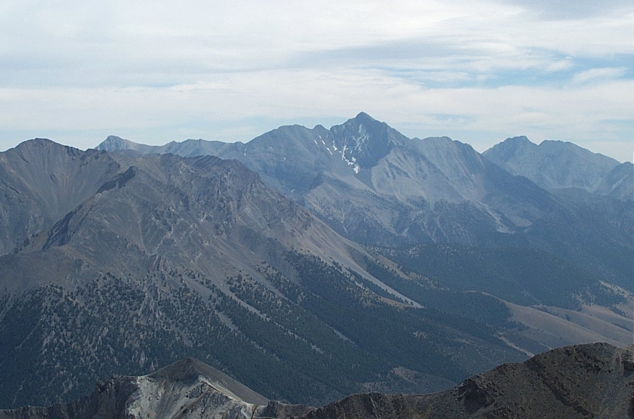
The North Face of Mount Borah from Rock Creek Topics on This PageGeographical InformationElevation: 12,662State: Idaho County: Custer Mountain Range: Lost River Latitude: 44.137°N Longitude: 113.779°W Historical InformationNamed After: William Borah, Idaho senator nicknamed the "Lion"First Ascent: T.M. Bannon (USGS Surveyor) in 1912 Alternative Names: Mount Borah, Beauty Peak Fastest Ascent: Luke Nelson, October 22nd 2010 - Car to summit in 1:26:42 and roundtrip in 2:21:11 Route InformationPopular Routes: Southwest Ridge (most common), North FaceSouthwest Ridge Mileage: 7 miles round trip Southwest Ridge Elevation Gain: 5,500 feet Southwest Ridge Class: 3 Getting ThereDirections: From Arco drive approximatley 45 miles north on US 93. Turn east on Birch Springs Road at the sign for Borah Peak access and drive to its end. At about 3.5 miles the road turns and runs along the earthquake fault of 1983. It then passes through a patch of quaking aspens and emerges at the parking lot. There are several campsites near the trailhead, a lot of parking, and a bathroom.Trailhead FacilitiesCamping Units: 5Toilets: 1 (Careful here, there was no tp the last time I visited!) Fee: None Water: None Elevation: 7,200 feet Season: May through November Frequently Asked Questions1. What is the prime season to climb the standard route on Borah Peak?July 15th - September 15th 2. Do I need an ice axe and crampons? When climbing Borah during seasons other than those listed, yes. Even during the months listed, an axe may be required on the snow crossing. During my ascent, there was snow on the ridge crossing, but it was beaten down into a 3-4 foot wide, 3 foot deep trail... no risk during crossing at all. 3. I've heard so much about "Chicken Out Ridge", do you have any suggestions when climbing it? I can't stress enough to stay on the ridge. Most people get in trouble by trying to bypass the ridge on one side or the other. 4. What kind of footwear will I need to wear? I wore my full leather boots, which were very handy on the loose stuff, but I felt their weight at the end of the day. A friend of mine has climbed the peak in trail running shoes and had no problems. Have a Borah Question, click on one of the links below to have it answered: Contact InformationLost River Ranger District716 W Custer P.O. Box 507 Mackay, Idaho 83251 Phone: (208) 588-3400 Fax: (208) 588-2924 North Face RoutesHere is a photo showing numerous technical climbing routes on the north face of Mount Borah: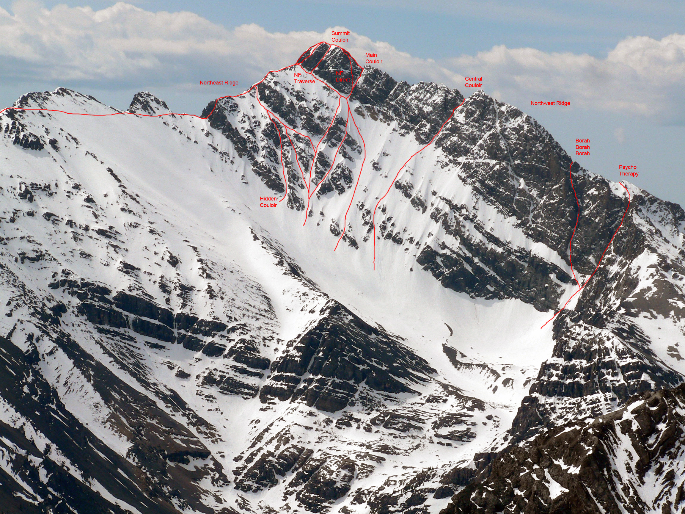
Photo credit: Me; Bob Boyles is credited with adding the routes - Click on image for full-size photo Climbers on the north face of Borah Peak: 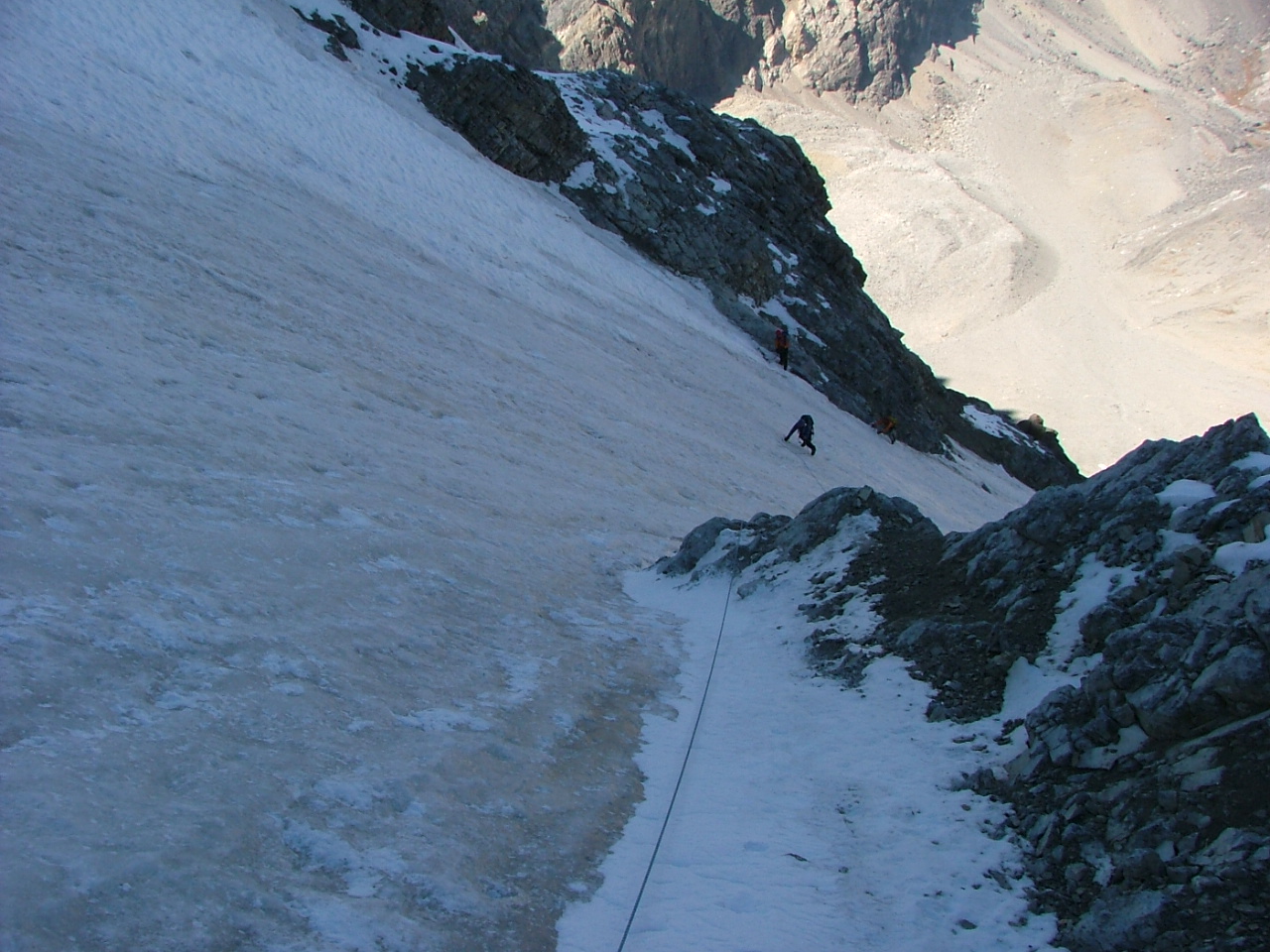
Photo credit: Dean Lords - Click on image for full-size photo Borah FatalitiesAccording to the forest service, 3 people have died while climbing Borah's slopes.
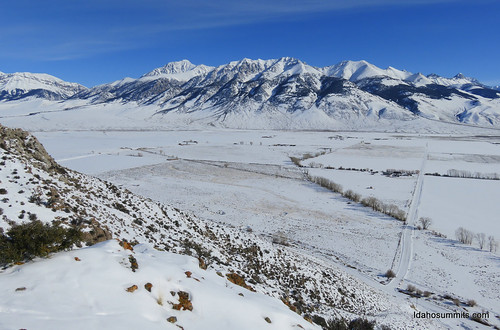
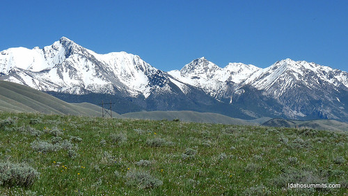
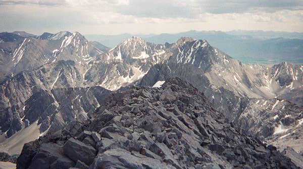
PicturesClick on pictures for the larger version
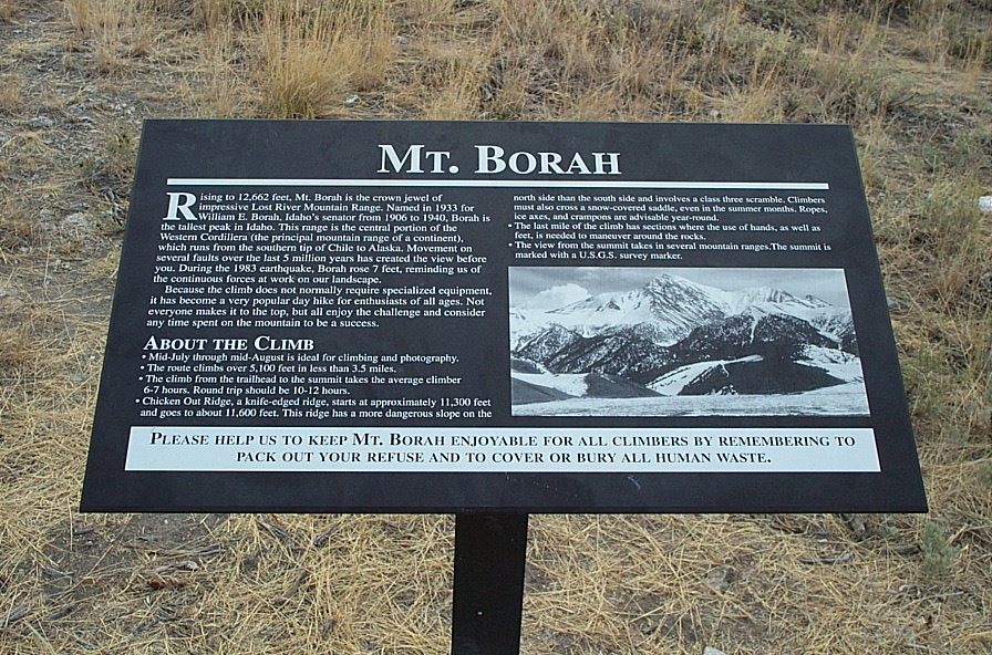
1983 EarthquakeIn 1983, an earthquake occured near the base of Borah Peak. The peak registered 7.3 on the richter scale. The earthquake raised Borah Peak 7 feet. The scarp is still visible along the western side of the peak and is crossed on the drive into the trailhead.Here is a sign near Borah that explains the earthquake: 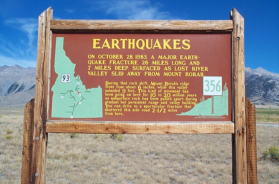
Click for larger image LinksCurrent Weather (Link to forecast)

All Rights Reserved RockyMountainSummits.com |